
10K/2.5K長跑賽
路線 Route
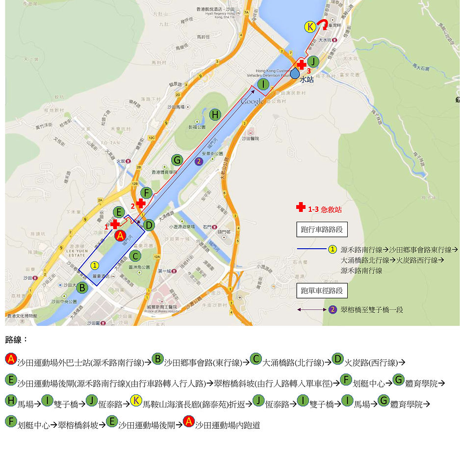
10K
路線由沙田運動場外(源禾路南行線)起步至沙田運動場內,全程約10公里。途經沙田鄉事會路(東行線)、大涌橋路(北行線)、火炭路(西行線)、沙田運動場後閘(源禾路南行線, 由行車路轉入行人路)、翠榕橋斜坡(由行人路轉入單車徑)、划艇中心、體育學院、馬場、雙子橋、恆泰路、馬鞍山海濱長廊(錦泰苑) 折返、恆泰路、雙子橋、馬場、體育學院、划艇中心、翠榕橋斜坡、沙田運動場後閘、沙田運動場內跑道。
The route from outside Sha Tin Sports Ground to inside Sha Tin Sports Ground is around 10km.
Outside Sha Tin Sports Ground(Yuen Wo Road southbound) → Sha Tin Rural Committee Road(eastbound)→ Tai Chung Kiu Road(northbound) → Fo Tan Road(westbound) → Sha Tin Sports Ground’s back gate(Yuen Wo Road southbound, enter pedestrian) → Banyan Bridge uphill(enter cycle track) → Rowing Centre → Sports Institute → Racecourse → Twin Bridge → Hang Tai Road → Ma On Shan Promenade(Kam Tai Court) → return to Hang Tai Road → Twin Bridge → Racecourse → Sports Institute → Rowing Centre → Banyan Bridge uphill → Sha Tin Sports Ground’s back gate → Inside Sha Tin Sports Ground’s running track